2012-02-28

Quanzhou, as seen by its stone turtles


1. 开元寺赑屭 / The ancient stone turtle (bixi) at Kaiyuan Temple. It has lost its stele.

If you are the Emperor of China, or just the chairman of a district government, and want to make an important statement, how do you do express your message? That's write: you have it written in stone, and then put the stone on top of stone turtle. Such turtles, which became known as bixi since no later than the Ming Dynasty, come by dozens in cities with strong imperial or Confucian connection, such as Nanjing or Qufu. Even Wuhan has at least one.

What about Quanzhou? Nestled on a river estuary off the remote Taiwan Strait coast, it has never been the capital of anything - but it still has a rich cultural history of its own. Would we see any stone-tablet-toting tortoises in its streets and squares?

The answer is a resounding "yes". Without specially looking (well, almost), I encountered half a dozen of them in a few days of sight-seeing.

The most remarkable of Quanzhou's stone turtles is, no doubt, the one that occupies the place of honor in the main yard of the famous Kaiyuan Temple. It has lost its stele, and I did not see any information about it posted nearby, but it certainly is of considerable antiquity, and has very much a style of its own - quite different from pretty much all bixi turtles I've seen elsewhere.


2. 天后宫之石龟(赑屭) / An ancient-looking turtle in Tian Hou Gong. The stele is illegible (or just blank?)


一幢龟趺碑在位于泉州市博物馆后面的碑林 / Another turtle stele, behind Quanzhou Museum. The inscription is legible, but I can't really read it, beyond figuring that it has to do with someone who earned his jinshi degree

3. 疏筑笋浯溪碑(1998年)/ Teenage bixi turtle

This one, although very much in the Qing style, was actually erected by the district authorities in 1998. It carries a stele commemorating the dredging of the Sunwu Creek, which is apparently of importance for the local flood control.


Restored Quanshan Gate, guarded by two bixi.

These two are pretty recent as well, as probably is [the current incarnation of] the gate itself.

A different kind of turtle


Typical turtle-back tomb / 闽南传统龟甲墓

A traditional grave of southern Fujian's coastal areas: a turtle-back mound surrounded by an Ω-shaped ridge. This was described by de Groot in the late 19th century already.


You see turtle-back graves like this all along the coast, from Hui'an to Xiamen, and in Kinmen as well. They are said to be common in Japan's Ryukyu Islands (Okinawa) as well.


While turtle-back tombs are the predominant type in Quanzhou's Lingshan Islamic cemetery as well, there is also a more Islamic version, where the Ω-shaped ridge is kept, but the "turtle mound" is replaced by a typical Islamic sarcophagus (or several) - just like those you'd see in a mausoleum in Kashgar or Istanbul.


Koxinga's equestrian statue seen on the horizon

[Previous: Lingshan Islamic Cemetery] [Next: Jinmen (Kinmen) ferries]

2012-02-22

Lingshan Islamic Cemetery, Quanzhou

One of Quanzhou's sites, mentioned in all guidebooks, but, as it seems, rarely visited by anyone, is the city's Islamic cemetery on Lingshan Mountain (灵山伊斯兰教圣墓). It is somewhat away from the city center, but I stayed nearby, and I went there for a walk. The admission charge is nominal (something like 3 yuan).

As usual, all images are clickable.


Welcome!

My self-guided tour of the place started in a fairly expected way, with the tombs of two famous mediaeval missionaries. Same Islamic sarcophagus-shaped tombs, covered with green fabric covers, as you'd see in any dignitary's mausoleum in Istanbul or Kashgar:


The tombs of the Two Worthies...

... and a stele to go with them.

The walk goes up to the hill next.


A view of Quanzhou's new sections from Lingshan Mountain

The famous "Balancing Rock"

As de Groot described in details a century ago, the traditional tomb style of coastal Fujian is a so called turtle-back tomb: basically, a grave mound in the form of a turtle's carapace, surrounded by a horseshoe-shaped (or, rather, Ω-shaped) ridge. There are apparently complicated feng shui reasons beyond this design. I had seen plenty of tombs like this on an earlier ride along the coast to Hui'an County; however I had not quite expected to encounter them in an Islamic cemetery. However...


A typical turtle-shaped tomb here, none the worse for the wear.

In case you have any doubts that the designers indeed had a turtle in mind...

Same turtle, front view

And another one

A low-budget "turtle".

Hu is buried here.

One, however, did not have to go either for the "Islamic feel" or for the "Fujian feel". One could mix and match:


This, apparently, is a hybrid design of sorts: an Islamic enough tomb in the middle, surrounded by a horseshoe-shaped (or Omega-shaped) embankment characteristic for the coastal Fujian.

The more modern section of the cemetery has large family (clan) sections.


This area is for the Ding (丁) clan.

The ability to mix and match in Quanzhou goes beyond the tomb design.


Apparently, being Christian (see the cross on the second tombstone from the right) does not prevent one from being buried at the city's Islamic cemetery, if you come from the right family.

Another apparently Christian tomb.

[Next: Quanzhou as seen by its stone turtles] - 2012-02-26 -

2012-01-12

Printing Google / Sogou maps

Have you had this experience? You've centered and zoomed the map of an interesting area on Google Maps, or a similar site (e.g., maps.sogou.com) and wanted to print it. Some map sites actually have a "print" button, or you can just use the "print screen" / "screen capture" button of your operating system's window manager to save the image into a PNG file to print it later (directly, or after including it and the caption text into an HTML / PDF / LaTeX file). But, whatever you do, chances are that the printed image will be almost un-readable: Google, Sogou, and other map sites optimize the image for on-screen viewing, and printing is just an afterthought.

There is, however, an easy way to improve the legibility of the map image. The idea is, an image is hard to read because there is not much contrast to it: both the brightest pixels (the background) and the darkest pixels (text and lines) are merely shades of grey (or, generally, some intermediate RGB colors), rather than good old printable black and white.

So the solution for improving the printable quality is, basically, as follows: figure what color you want to convert into black, what color you want to convert into white, and linearly transform all colors in between.

There are of course plenty of image manipulation tools on the market. The one I happen to use is ImageMagick, and sure enough, it has a command for it.

To find the colors to be made into black and white, you probably can zoom in on your screenshot image in some image editing program, and take a look at what the RGB values for the darkest pixels (parts of text, or lines showing roads etc) are, and what the RGB values for the brightest pixels (the not-quite-white background). In my case, I did it with cropping out a small section of the image with "convert -crop", and then querying the range of colors with "identify -verbose". Having chosen the colors this way, all you need to do is a single command:

convert original-map.png -level-colors 'rgb(144,144,10),rgb(241,238,232)' printable-map.png

Enjoy!

Before After

2012-01-06

I know how to say "to loiter" in Chinese

I used to joke that the English verb "to loiter", as in the "No loitering" sign, is one of the words particularly hard to translate to other languages. Well, thanks to David Feng's useful post with the do's and don'ts of picture-taking in China's railway and subway stations, I now know that at least in Chinese they do have a word for it: 久留 (jiuliu), which means more or less what its components indicate.

2011-12-24

This has not been reprinted since 1953?

(This is a slightly expanded version of a book review on Amazon.com)

Matteo Ricci's and Nicolas Trigault's "De Christiana expeditione apud Sinas", translated by Gallagher as "China in the Sixteenth Century", is, arguably, one of the most important books of the 17th century. (Look up that title on Wikipedia: it was me who wrote the article there). A fruit of Matteo Ricci's pioneering experience as a Jesuit missionary in China (1582-1610) it both provided Europe with its best "standard reference" on China for a the next several decades, and articulated Ricci's [[ASIN:0824812190 "accommodationist"]] strategy, which Jesuits were to follow for the next century in their attempts to make Christianity acceptable to the Chinese literati, and Chinese Confucian world view, to Europe's ecclesiastical and intellectual elites.

Matteo Ricci was not the first Catholic missionary to work in China, and not even the first one to write a book about the country. (The Portuguese Dominican friar Gaspar da Cruz, who spent a few months in Canton in 1556, and published his book in 1569, may be the one to claim the honor, if we ignore the Papal envoys who had been active in the Mongol-dominated China ca. 1300). However, what he (and his lesser known older comrade, Michele Ruggieri) did was cardinally different from what the previous generation of missionaries did. Da Cruz, or the Spaniard Martin de Rada (an Augustinian who entered Fujian from the Philippines for a few months in 1575) were utterly dependent on their interpreters, and were not all that "nuanced" about the "pagan" rites and beliefs to be condemned and exterminated. No wonder that they did not get all that far in their abortive attempts to get established in the Ming China.

In contrast, Ruggieri and Ricci, in the best Jesuit tradition, painstakingly worked on learning the spoken and written language of the country and trying to figure out what beliefs and principles guided the people of this land in their actions. All the same time, the two Jesuits plotted how they could get themselves closer to the Ming Empire's centers of power; much of the book thus is the story of their progress (taking almost two decades) from the Portuguese base in Macao to inland Guangdong's Zhaoqing and Shaoguan to more central Nanchang to the empire's "backup capital" Nanjing and, finally, to the Emperor's court in Beijing.

As a result of this enormous effort, Ricci was able to create an encyclopedic book that represented a much higher level of understanding of China than did Europe's previous "standard reference", [[ASIN:1108008194 History of the Great and Mighty Kingdome of China]] (which was written by a Spanish-Mexican Augustinian who had been appointed by the Spanish court as its envoy to China, but, alas, never got beyond Mexico). More importantly, he armed the Jesuits with a "modus operandi" that viewed Confucianism as a generally "positive" a-religious ideology, which could be used as an ally against the competing religious faiths (Buddhism and Taoism). While a modern academic study such as David E. Mungello's [[ASIN:0824812190 "Curious Land"]] may be a better way to learn about the Jesuits' approach (and the opposition to it from some of Europe's Catholic hierarchy), nothing replaces reading Ricci's original work for the sheer feeling of amazement at what Ricci and his colleagues did trying to understand the very different civilization from what they had left behind in Europe.

Well, how *can* you read Ricci's original work? His original "journals" were, naturally enough, in Italian, and not even published until the 20th century. (The work, "Fonti ricciane", with comments by Pasquale d'Elia, is not even on Amazon; see the Wikipedia article for the bibliographic information). Ricci's younger colleague, Nicolas Trigault, posthumously edited his work and turned it into Latin, and had it published in 1615; it quickly became a Pan-European bestseller, translated into Europe's most major languages; that all can be found on Google Books and/or in archive.org. The most recent English translation is apparently by the American Jesuit Louis J. Gallagher's, first published as "The China That Was" in 1942, and then (with a Chinese-words index based on d'Elia) in 1953, as "China in the Sixteenth Century: The Journals of Matthew Ricci: 1583-1610".

So the second edition must have been timed for the 400th anniversary of Ricci's birth; what surprises me is that such an important book has not been reprinted, say, in 2002 (for Ricci's 450th anniversary), or in 2010 (for the 400th anniversary of his death). But here we are: one of the most important documents of the Christian missionary history - if you want a complete English translation - is only available as an out-of-print book. Fortunately, most university libraries still would have a copy...

2011-12-05

We ain't no Class A!


I must have been to the US perhaps a hundred times, but the last Saturday I had the strangest entry experience so far. I am presently working in the US in a TN-1 (NAFTA professional) status, and as my current admission period is coming to a close, I decided to combine a vacation with a "border run", to obtain a new permit upon re-entry. People usually do at at border crossings or airports, but this time I was to go overseas (well, to Mexico) by boat! Carnival runs weekly cruises ships out of New Orleans to Mexican ports, the weather is nice, and, hey, we have long wanted to see some Mayan ruins.

The trip was much as expected (I will write about the Dzibilchaltún visit some time later), but re-entry was a surprise. The US Code of Federal Regulation states (CFR 214.6 (d) (2)) that eligible individuals can apply for the TN-1 status at any Class A point of entry, and CBP lists the Port of New Orleans (and in fact, quite a few smaller sea ports in Louisiana) as a Class A port of entry. (They definition they give is that a Class A facility can process all kinds of aliens, while a Class B one is only set up to deal with permanent residents, and Class C, with foreign sailors. Of course US citizens can enter their country through a port of any class).

This being said (and written), I naturally expected the entry facility (Erato Street Cruise Terminal, to be precise) to look much like a similar facility at any international airport - a row of immigration check points, with a "secondary inspection" area in the back for the cases that need more paperwork, the baggage claim area, and then the customs check. Or it could be like one of the smaller land border crossings, with inspectors combining both roles, but, presumably, still with their bookcases of immigration manuals, drawers full of ink stamps and tables with printers. Well... when our beautiful Panamanian ship (without a single Panamanian on board, methinks) was tied up at the quay, and after a couple hours of waiting on the deck and in lines we finally reached the immigration checkpoint, I indeed had a surprise: not only were the immigration/customs roles combined, but after a brief conversation it transpired that they pretty much don't do any serious immigration work other than simple passport / I-94 checks.

I reckon that the focus there is mostly on customs checks, and not on immigration. This, I guess, is entirely justified from the pragmatic point of view, as it is expected that everyone who's coming to New Orleans on a cruise boat have left the same Port of New Orlean on the same boat a few days prior, and was either a US citizen or a properly admitted (and re-admissible) foreigner. So when coming back, s/he presumably would be readmitted in whatever status, and for the remainder of the same admission period, that he had before departure, thanks to the doctrine of the automatic revalidation.

Still... it is the cruise line personnel, not the CBP who checks the validity of the departing passengers's documents before they board. (This, of course, is much like what happens when passengers board an international flight: the airline is responsible for ensuring that the boarding passengers have the proper documents to at least "make an application for admission" at the port of entry of the destination country; otherwise, the airline is liable for transporting them back, and additional fines.) Surely there would be occasions when the passenger was generally admissible but still would need a new I-94 on re-entry? A somewhat far-fetched example is a foreigner with a valid visitor visa whose current I-94 is still valid on the day of departure, but is expiring during his cruise? A more realistic situation would be a cruise going from New Orlean to a Caribbean country other than Mexico. For travel to Caribbean islands, automatic visa revalidation only applies to aliens on student visas. Which means that all other foreigners with valid visas and I-94s, or on visa waivers, will have their Forms I-94 or I-94W invalidated once their ship stops at a place like Cayman Islands - won't they need new I-94 or I-94W issued once back in a US port? How would CBP at Erato Street deal with this?

On a more practical note, it seems to me that there are many people who consider the typical cruise travel mode (a 5 day trip, with only 16 hours in foreign ports) a waste of time, but would love to travel by boat if it were possible to schedule it in the same way you do airline flights. That is, if you could spend 2 nights and one day relaxing on a boat from a US port to Mexico, disembark there and have your week or two sitting in a Cancun hotel or hiking through the jungle, and then hop on a boat again for another 36 hour trip back to the States, it could attract a whole new set of customers to the cruise boat business. But for this to work, the boat companies would have to work with the government to set up full-service immigration processing at their US terminals.

2011-10-30

The first frost - now for real

The "official" reports showed the low of only -1 C last night (Oct 29/30) here in Bloomington, Indiana, but that was enough to put the end to the growing season for the warm-weather crops. Tomato plants are dead all over town. Morning glory and basil mostly did not survive this either.

About time, I guess...

Some of our pepper plants, surprisingly, are still more or less alive. Perhaps, planting them on a slope helped a bit; also, the plants were somewhat sheltered from above by bean vines on the fence.

Now - as it so often the case - the forecast is for a few much warmer days. But that will only be of interest to cabbages, radishes and such.

2011-10-22

The first frost (almost)


Time to harvest me!

The clear night of Oct 21/22 saw the first, very light, frost in parts of Bloomington, Indiana. Official data showed the low of -1 C (+30 F) that night, but obviously it varied between locations.

It was interesting to see its effect of such a "marginal" frost in the garden, as it provides an opportunity to see a fine difference between the sensitivity of different plants, or in the microclimate between different locations in the yard.

Even though peppers are generally said to be hardier than tomatoes, our sweet peppers and jalapeños were unscathed, but a few of the cherry tomato plants, growing near the lowest point of the garden were lightly "burned".


Too old for silk melon, to young for loofah...

The end has come for the two last melon/squash species in the garden. The winter melon (冬瓜) vines, on the ground, were killed, and so were most leaves of the silk melon (a.k.a loofah; 丝瓜) climbing on the fence and trees. The remaining fruit of both were, though intact. (The winter melon probably will be quite useful, but the silk melons appear to be at that awkward stage when they are too hard to eat, but have not yet dried to be conveniently made into loofah for the shower use). The vines of all other melons/squash plants we had had died many weeks ago, in August-Septmeber, God knows why - maybe it was too dry, maybe it was just their natural life cycle.

We had a couple cucumber plants planted in August as an experiment, trying to see if it is possible to obtain a second crop of cucumbers. That did not really work out: the plants struggled during the hot August, and now died with the first frost, producing all of half a cucumber between them.

A few of the morning glory leaves were burned by this mini-frost too, but, interestingly, they were mostly the leaves on top of the fence where the morning glory lives. So the effect in that area must have been not so much from the cold air, but from radiative cooling.

The okra, even though always considered a warm-climate plant, looks more or less alright - although it's pretty useless during the cooler part of the fall, producing hardly any pods anymore. (Not like in the summer, when a pod needs to be picked within a few days after blooming, lest it becomes too tough).


Beans are doing pretty well, so far...


Everything else still looks fine - even most of peppers, tomatoes and beans (growing on a slope, as well as most peppers; this may have helped them a bit; of course, their days are counted now...), as well as the hardier leaf vegetables (various brassica species, radishes, lettuce etc, as well as various ornamentals).

Well, it's only days until the first real frost, probably...

Emperor Zheng Ho, meet Comrade Kirov!

This review is from: Fra Mauro's Map of the World (Terrarum Orbis)

This product consists of two parts: a CD-ROM that contains a high-resolution scan of the famous Fra Mauro Map, and a huge book that contains transcripts of the labels on the map, their English translations with comments, and a couple hundred pages worth of articles about the various aspects of the map.

This map, created by the Venetian monk Fra Mauro ("Brother Mauro") ca. 1450 is, of course, famous, being perhaps the best example of the European map-making on the cusp of the Age of Discovery. A copy of this map was actually made for the Portuguese king of the day, so you could imagine Bartolomeo Dias and Vasco da Gama studying it in preparation for their pioneering voyages to[ward] Asia; Columbus may have looked at some similar map, wondering how far its western end really was from its eastern end.

Basically, it may be viewed as the last great maps created before two great revolutions - one in maritime technologies, allowing the Europeans to sail all over the world, and the other in book reproduction (the [re-]invention of printing in Europe) - revolutionized European cartography and led to the appearance of works by Mercator, Ortelius, etc. in the 16th century.

Fra Mauro's map is famous, in particular, because it appears contains a lot of geographic information that is (more or less) correct (i.e., not entirely fantastic), but about whose provenance we don't know anything. That is, the good Brother Mauro must have gotten it *somewhere*... but whatever his sources were, they just have not survived to our day. As one example, it shows a fairly reasonably-looking continent of Africa, one you can sail around, even with a Madagascar of sorts (called "Diab") south-east of it... all this a generation before Dias and da Gama.

Now, what do this book and CD give you? There is actually a small printed map coming in a pocket with the book, but since the original map was *huge*, you can't read much of anything on that small map, beyond the names of countries and major regions. The CD has of course high-resolution data - much better than a freely downloadable scan file available e.g. via Wikimedia Commons. But the data are not in some standard portable format such as JPEG or PDF; rather, they are only readable by some specialized program, for the Microsoft Windows operating system, included on the disk. So this is rather inconvenient, if you are used to view images in some general-purpose image file viewer. For example, the program's interface allows you to scroll through the image, or to zoom in on a small piece of it, but you can't zoom out - which means that you can't see more than a very small part of the entire map on the screen at once (unless, that is, you have a really huge screen, or can control your monitor's resolution to be 10,000 by 10,000 or something...) The "transcription" feature, however, is quite convenient: you can click on any text on the map (label, caption) and to see the transcription of the Italian original, or its English translation, as plain text in a pop-up window. A great help for someone not too comfortable with Mediaeval handwriting. (Although I'd say that the text on the map is fairly legible as it is).

The luxuriously printed book itself is... useful, although one wonders if the publisher could come up with a more compact format for what is, basically, a huge dictionary of transcribed and translated map labels, which now happens to be formatted so that most of the pages are 80% blank space. (This is why the thing probably weighs 5 pounds if not more).

The articles, written mostly by the curator of the maps at the Venetian Library, with a contribution from an art historian, are certainly very valuable for anyone interested in the "life story" of this particular map, and in Mediaeval cartography in general. The author tries to probe the problem of "missing sources", and come up with interesting ideas here and there. (Arab manuscripts; interviewing visiting Ethiopian and Russian churchmen...). Overall, he feel that "no longer identifiable oral accounts", mentioned by Fra Mauro himself (p. 33), were an important source in the creation of the map, so, in a sense, many critical "sources" of it probably never existed as written documents; and we probably should agree with him.

At the same time, it seems that quite a few silly statements, or at least unexpected omissions, are hidden in plain view among the books' annotations. For example, the famous seven 15th-century Chinese expeditions to the Indian Ocean are described as being "ordered by emperor Zheng Ho" (item 19, pp. 178-179). (Hint 1: the emperors at the time were Yongle and Xuande; Zheng He was the eunuch in charge of the fleet. Hint 2: with Chinese names, you either use the modern Pinyin transcription [e.g. Zheng He] or the more traditional Wade-Giles [Cheng Ho], but try not to mix the two, at least not in the same name). Mozhaisk (the center of a small Russian principality west of Moscow) is described as having become "famous for its resistance of the Mongols in 1237-40" (pp. 91-92). (Hint: the small city famous for its resistance to the Mongols during that invasion was Kozelsk; I don't believe there was anything ever said about Mozhaisk in that regard). While "Provincia Mordua" is absolutely correctly linked to the Mordvin (Mordva) people, it is quite amusing to read that the nearby "Provincia Quier" "suggests a reference to the city of Kirov" (p. 93). (Hint: Kirov was so named after the pseudonym of a Soviet Communist leader, S.M. Kirov, in the 1930s; the place was known as Vyatka or Khlynov during the preceding 1000 years.)

Neither of these issues is a major one, and one cannot expect them all to be visible to any single author or editor; but if they are noticeable even to a casual reader, I wonder what an expert in the historical geography of a particular region would say if asked to proofread the chapter on the area of his expertise. The book probably could have benefited from having such a proofreading done in advance of its publication. Nonetheless, even as it is, this weighty volume is a valuable addition for any research library with a budget to afford it and the shelf space to go with it.

2011-09-25

Not enough exorcists

Via LiveJournal: A Russian TV program (and the bishops they have interviewed) complains that the nation's Orthodox Church does not have enough trained exorcists. According to them, we are not doing enough to catch up with the competition: this spiritual "service" is supposedly much more widely available in Catholic countries.

2011-09-18

The world's railways, all on one map

Bill Rankin, of Yale University, has a wonderful map of world's railways (2008) on his site http://www.radicalcartography.net , with some thoughtful comments on how it reflects on the economic history of the world's nations.

His site does not seem to provide a space for readers to comment, so I would like to do it here.

First of all, a good way to describe this map would be not simply as a map of world's railroads, but rather as a map of (almost) all railroads, of any type, that ever existed prior to ca. 1990.

There are two reasons for this situation.

(1) First, a map like this brings to the fore a major issue for creating any railway map: the adequacy of sources. It seems that sometimes it is not easy for a newly-built railway to get to maps (especially published in other countries); but it is even harder for a dismantled railway to disappear from maps! The most prominent example visible of Rankin's map is perhaps the Newfoundland Railway, closed for good in 1990, but still gracing many world maps with its presence. Less visible is the Kettle Valley Railway southern British Columbia. Its western section, abandoned in the early 1960s, is gone from most maps (including Rankin's), but the eastern section, physically dismantled in the early 1990s, keeps living in the world of maps, including this one.

As a more interesting example, a good section of Stalin's pet project, the Salekhard–Igarka Railway in the north of western Siberia - namely, an east-west section across the northern part of Tyumen Region - actually saw trial service for a short time before the incomplete rail line was abandoned in 1953, and some western maps at the time showed the western half of this Arctic railway as operational. (I own a 1950s-vintage Rand McNally atlas which does so). Although that railway did not take root in the world of cartography, it somehow made its way into Rankin's masterpiece - presumably because the author tried to work with the most comprehensive sources available.

On the other hand, some of the more recently built railways - e.g., the China-Kazakhstan connection and the Turkmenistan-Iran connection, both activated in the early 1990s - aren't on the map, nor is the Kashgar railway in China's Xinjiang (also built in the 1990s; and it now has branches that only became operational after 2008...)

A peat railway, near Esterwegen, Germany

(2) Second, more detailed maps try to distinguish different types of railways, but in this comprehensive map it apparently was not possible. But a distinction we must make. For example, anyone used to looking at general-purpose maps of Russia and China can't but be amazed at some small but extra-dense clusters of rail lines which, according to Rankin's map, exist in the north-east of European Russia (roughly, the region between Arkhangelsk, Nizhny Novgorod (Gorkiy), and Yekaterinburg (Sverdlovsk), and in China's Heilongjiang and Jilin provinces (the northeastern part of what we used to call Manchuria). There is no mystery here, however: these are so-called logging railways (and, on rare occasions, peat railways). They are very different from standard, permanent, railways operating in these countries. A logging railway is typically a narrow-gauge railway, laid at the minimal cost, and only used to move logs from the woodlots to a mainline railway station or a sawmill. I understand that many sections of such railways are only used for a few years, and then, once that particular section of the forest has been cut, moved to a new location. A general-purpose Soviet or Russian map would never show them, but a topo map would... giving one probably an exaggerated idea of an area's rail density, as in reality many of the lines shown would not be actually operational anymore (see (1), above). Anyway, by now, I suspect, most of these logging railway live on cartographers' desks, as the timber industry has mostly switched to using trucks.


A sugar cane railway, near Proserpine, Queensland, Australia

A somewhat similar class of railways are sugar-cane railways, which apparently are responsible for the extraordinary visible density of railways in Cuba, Mauritius, parts of Taiwan, and even a rail line in Fiji. I am not sure if the map shows the sugar railways of Queensland - I think if it did, there would be a more dense network there. The sugar railways are, like forest railways, narrow gauge (sometimes, very narrow gauge), and only used to move a particular type of cargo. Unlike many forest railways, sugar railways are permanent, even if used for only a few weeks in a year, to transport cut canes to the nearby sugar mill. Their existence is made economical by the fact that sugar cane's yield, in tons per hectare, are much higher than those of most other crops grown on similarly large scales. I know that at least some such systems in Queensland are still very much in operation, and I've seen tracks for one of them in Fiji (no idea if they are ever in use, though), but I don't know about other countries.

(3) Dr. Ranking contrasts the American (meaning, here, US, Canada, and Argentina) railway network to systems elsewhere, by justly noting that "In the Americas, rail was the primary route by which crops reached global markets, and railways and settlement often went hand in hand." This is true in a sense - the remarkable dense networks covering the fairly sparsely populated agricultural regions of the Great Plains of the US and western Canada, central Argentina, as well as the grain-growing areas of Australia's Victoria and Western Australia are quite remarkable. But one should not forget, at the same, how extraordinary and short-lived phenomenon these networks were. They were, basically, brought to life by the particular situation that obtained during several decades in the second half of the 19th century through the early 20th century: the railway technology was much more efficient for moving grain and other cargoes overland than any other option available (which, in those areas mostly meant a horse and a cart).

It seems that soon after trucks became widely available and the governments subsidized highway construction, the less-used 50% (sometimes 90%) of this unique rail network became abandoned. The system reverted to a form more "sustainable" in the truck-and-road based economy: railways connecting major transportation hubs, with trucks moving grain and containers to the surviving high-volume stations. If one were to wipe all disused railways from the US/Canada/Argentina/Australia maps, and add all new railways that have been built over the last several decades in countries like China or Iran, I feel that the overall density of the operational railways today's in North America won't be that difficult from the comparable population-density regions of eastern Europe and Asia (Russia, Turkey, Iran, north-western China). And it will be only natural for high-population-densities regions in India and China to soon surpass the US and Canada with respect to the railway network density.

In a sense, I wish very much that all those rail lines that have been abandoned or converted to bike trails became active railways again, and all kinds of factories, warehouses, and other businesses - even post offices - moved back to the trackside districts, where they could ship and receive their freight directly by rail... but this isn't going to happen unless a very radical change in the different modes' transportation costs occurs.

As a comparison, in the late-19th century Russian Empire, the need to carry export grain to the sea ports was also a major stimulus for the railway construction boom. But the country - not even its most fertile areas in south-western Russia and Ukraine - never acquired as dense a system as Iowa or Saskatchewan had for a few decades in the early 20th century. Partly this indeed must have had to do with the availability of capital and the general level of the development of the national economy, partly with the simple transportation economics: with lower crop yields per acre, and much higher local population densities, I suspect that the net amount of grain to be exported from any 100-square-miles region of Ukraine or the Saratov Governorate was rather smaller than from a similarly sized piece of Iowa. As a result, they have not had to abandon all that much of railway trackage, except for in a few areas where the construction was moved by "mining or manufacturing", as Dr. Rankin says, and where that mining (or, less commonly, manufacturing) is gone. Among the lines still shown on the map, an example of this is a large part of the branch that goes east from Apatity and Kirovsk in Russia's Kola Peninsula.

2011-07-08

"Curious Land: Jesuit Accommodation and the Origins of Sinology" by David E. Mungello

(This is a slightly expanded version of my book review on Amazon.com)

I read David E. Mungello's Curious land: Jesuit accommodation and the origins of Sinology a few years ago, almost by accident. The book sat on a library table, waiting for reshelving, and the cover looked sort of ... curious. I wondered for a short while if this is just one of many lightweight popular-history books that, basically, regurgitate the same well-known facts in different order. But once I opened the volume, I saw that it was full of names and events I had not heard about. So I checked it out, just to see if it will be interesting enough to read throughout. As it turned out, not only was it interesting enough - the subject area it discussed was just so interesting, that I have read another dozen books on related topics since then!

There are many good and not so good books about contacts between Europe and China, but, as I said, it seems that many of them give you a pretty superficial review of the same basic points, spiced with a few more or less familiar anecdotes. "Curious Land" is very different. For one, D.E. Mungello strictly focuses on the subject matter (Jesuits in China, and their European contacts) and the time period (from the Jesuits' arrival to China, i.e. ca. 1580, until 1700). Which means that many other stories - such as the Portuguese' arrival to Chinese coast and their early exploits, or the Spanish Dominican and Augustinian friars' attempts to bring gospel to China are not covered in this book; nor is any of the post-1700 history. (If you are interested in any of this, The Great Encounter of China and the West, 1500-1800 by the same author can be recommended for a much more concise and "non-specialist" overview of the "big picture" and for more literature pointers. C.R. Boxer's works, and in particular his South China in the Sixteenth Century (1550-1575) - an annotated translation of the narratives of Galeote Pereira, Gaspar Da Cruz, and Martin De Rada - are perhaps the best coverage of the early Portuguese and Spanish contacts; this last book would give you a good idea of what the first Jesuits to work inside the "mainland" China, Michele Ruggieri and Matteo Ricci, may have read about the country on their way there).

More importantly, having delimited his topic so precisely, Dr. Mungello manages to provide a really in-depth study of what the Jesuits saw in China, how they understood it, how they presented it to the European audience, and what was the reaction of Europe's scholars. He explains in detail the "accommodation" policy developed by the Jesuit China Mission's founding father, Matteo Ricci, and promoted by several generations of his successors. The policy tried to make Christianity acceptable to Ming China's literati by declaring that Confucianism and ancestor veneration are, in principle, compatible with Christian faith, because they really are just a system of moral and political beliefs (fully compatible with Christianity) and civil rites (which, with certain reservations, can be accommodated in a Christian's life as well). This truly Jesuitical (hey, I have chance to use this word!) view of the Chinese world affected of course both what Jesuits said and did in China (e.g., not talking too much about Crucifixion and Resurrection until a prospective convert was ready) and what they said about China in Europe. The "accommodationist" ideology (and its later, Qing-era development, known as the "Figurism") may have been quite successful in making Christianity a truly widespread religion in China, but it came under attack from influential Christian purists in Europe, and was eventually disallowed by the Pope, drawing the period of flourishing Jesuit activity in China to an end.

Nonetheless, over a century of Jesuits' study of China, its language, philosophy, history and culture resulted in the creation of a tremendous intellectual capital, quite influential with a number of European thinkers of the period, from Leibniz to a group of rather obscure scholars in the Prussian capital Berlin. While the story of the latter group may be just a vignette in the overall story of the Sino-European intellectual contact, it certainly is worth telling, and Dr. Mungello's does it very well too.

2011-06-21

A visit to Hindustan (and beyond)


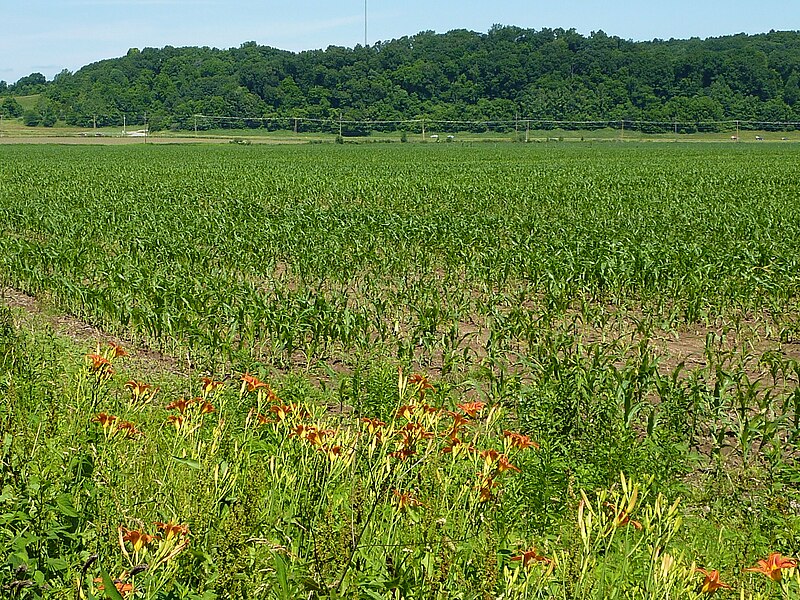
One Sunday morning, I went to Hindustan. Not a lot of Hindus of Muslims were to be seen, but the Pentecost service was at full swing at the local Christian church. Alas, I did not have proper clothes to join...


Typical landscape nearby: corn and day lilies. (The second most common crop there is corn).

A girl demonstrates a very friendly box turtle, which had recently just walked in into the family home's garage. The creatures apparently liked to be petted, and would not pull in its head and legs, as turtles are apt to do


And, a couple hours later, I am in Brooklyn already.

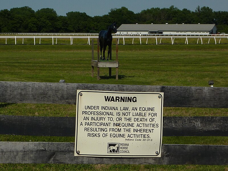
Equine activities, anyone?


Well, maybe it's good that I did not go by train...

2011-05-27

Simply a marvelous picture...

(A Great Blue Heron caught a small Common Snapping Turtle. Photo by jayhawk6 on Flickr.com, via Wikimedia Commons)

Almost a real-life illustration for The Fight Between the Snipe and the Clam.

2011-05-24

Edward Kajdański's take on the sumxu

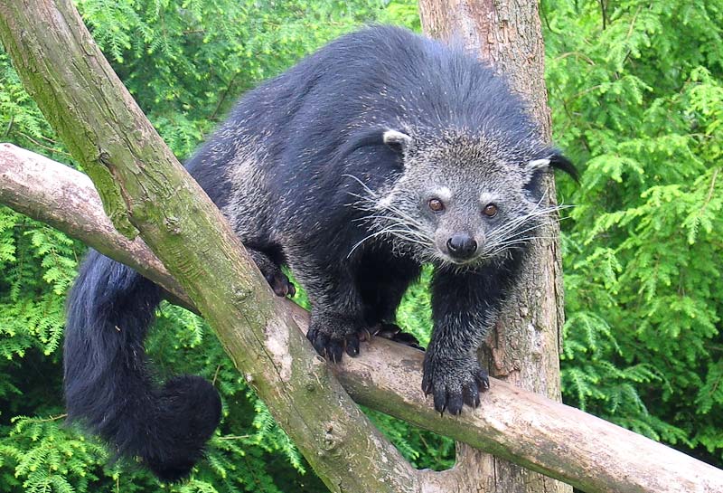
Binturong, a.k.a. the Asian Bearcat - one of SE Asia's civet-like animals. (Photo by Tassilo Rau)

I wrote a while back about the sumxu, a strange creatures described by the 17th-century Polish Jesuit Michael Boym in his Flora Sinensis (1656). Sumxu is Boym's transcription of the Chinese 松鼠 (songshu, in the modern Pinyin transcription), which means "squirrel" (literally, "pine rat"), and Boym's picture is so labeled in both Chinese characters and in transcription, and the creature depicted certainly looks squirrel-like. However, Boym's text says that people kept those sumxu as expensive pets, valued for their ability to hunt mice - which, of course, is a rather strange thing for a real squirrel to do. The sumxu became popularized in the European imagination by Athanasius Kircher, who in China illustrata (1667) compared it to a cat... and the story lived in European books for the next 200 years. A number of people tried to solve the riddle of the sumxu; in particular, it has been suggested by some that due to some confusion on Boym's or his informants' part, the sumxu (松鼠, "squirrel") label got attached to a different animal, from the mustelid family, such as the yellow-throated marten. Here's the promised update on the work of one researcher who spent a fair amount of effort tackling the sumxu mystery. Polish diplomat and writer Edward Kajdański published three books (and a number of articles) on Michael Boym. The last of them, Michał Boym – Ambasador Państwa Środka ("Michael Boym, an Ambassador of the Middle Kingdom"; 1999; also available in a Chinese translation by Zhang Zhenhui (张振辉) "中国的使臣卜弥格", 2001) has a chapter on Flora Sinensis, with a few pages on the mysterious green winged turtle and the mice-hunting sumxu. For some reason, Kajdański keeps referring to the creature as the "sumxu cat" ("kot sumxu"), although Boym himself did not mention cats at all, and Kircher merely compared the sumxu to a cat. Kajdański has a number of interesting ideas about the sumxu, but, to be honest, I can't quite make sense of how he puts them together. Kajdański somehow links the origin of Boym's famous sumxu-and-turtle picture with the Polish Jesuit's "fascination" with the travels of Marco Polo. Marco Polo in his Travels talks about the musk deer, the mysterious (for Europeans) source of the precious musk - and says somewhere (in some editions of his Travels, at any rate) that the creature was cat-sized. Somehow, through a logical connection that I don't quite understand, the Polish researcher then infers that what Boym really had in mind when drawing the sumxu was, too, a musk-producing creature, namely, something from the civet family. Kajdański even says that he saw a matching creature - looking sort of in between the Siberian weasel and the small Indian civet - in the Natural History Museum of Kunming, but, alas, was not able to find out its Latin name. The next thing Kajdański does (and I can't quite figure the connection to it either), is to suggest that sumxu/松鼠 (Pinyin: songshu; meaning "squuirrel", or, literally "pine mouse/rat") with the "snake-eating mouse", 食蛇鼠 (Pinying: shi-she shu; likely Boym-era transcription, xixexu, though Kajdański suggests shuxexu) - a creature mentioned in the famous Chinese compendium of materia medica, Ben Cao Gang Mu. Boym indeed must have been well familiar with Ben Cao, as he wrote extensively on Chinese medicine; and such a "snake-eating mouse" (or "rat", if you wish) is indeed mentioned in that work. However, I think it rather unlikely that Boym would choose that creature for including into his fairly small work - really, a selection of the most interesting and important plants and creatures of East Asia for the erudite European audience. After all, Ben Cao only has a couple lines on the "snake-eating mouse". It says that, according to the Book of Tang, such a "snake-eating mouse", with a pointed mouth and a red tail, was sent as tribute by the country of Jibinguo (罽賓國/罽宾国; Kapisa (?) in Northern India), but noone has heard of such a thing lately (i.e., in the 16th century, when Ben Cao was compiled). (I suppose what the Indians actually sent to the Tang Emperor was a mongoose of some kind). Kajdański says that according to the old pharmaceutical works (presumably, the same BCGM), the creature Boym had in mind (not entirely clear to me whether he refers to the same shi-she shu or the civet-like creature that he saw in the museum... I guess he identifies the two) was indeed valued in old China, and could be kept (on a leash, presumably) with a silver collar. However, he says that what the creature was valued for was not its mice-hunting prowess, but it's anti-snake powers. First, the creature was said to be able to locate venomous snake by their scent; second, the creatures own musky smell would repel such venomous snakes from the place where it was kept; third (which Ben Cao indeed mentions), if the creature's owner still had a misfortune of being bitten by a snake, he only had to have his shi-she shu urinate on the bite wound, and it would save him from the venom! This all sounds like a fascinating legend indeed (certainly goes way beyond Kipling's Rikki-Tikki-Tavi!) - just the stuff Kircher would love. If Boym really had such a thing in mind - how come he did not pass the story to Kircher, instead of just telling him about a comparatively boring mouse-hunter?

2011-05-16

Bus to Sydney, anyone?

The photo, taken last January, shows the interior of a two-level bus in Wuhan. The sign says, "武汉公交欢迎您" ("Wuhan Public Transportation welcomes you"), and - as I have just noticed - displays a likeness of a building remarkable similar to Sydney Opera House. Does Wuhan bus system plan to run a route all the way to Sydney? Or is the city preparing a replica of the theater, on a suitably shaped peninsula somewhere in the East Lake? (Incidentally, this is probably bus no. 536, the one that takes quite a bit over an hour to cross the city from the Hankou Station to the eastern edge of Wuchang).

2011-05-13

Protecting Mr. Bezos

Looking through Amazon.com's Year 2011 Proxy Statement (page 19), I found the "2010 Summary Compensation Table":
Name And Principal Position Year Salary Stock Awards(1)All Other Compensation Total
Jeffrey P. Bezos, Chief Executive Officer 2010 $ 81,840 $ — $1,600,000(2) $1,681,840
2009 81,840 1,700,000 1,781,840
2008 81,840 1,200,000 1,281,840
Thomas J. Szkutak, SVP and Chief Financial Officer 2010 160,000 6,465,300 3,200(3) 6,628,500
2009 160,000 3,200 163,200
2008 157,500 7,491,000 3,150 7,651,650
... etc... (similar numbers for three more SVPs) ... etc ...
Nothing much unusual about these data. Publicly traded companies are required to publish this information. The executives' salary does not need to be high (in fact, Mr. Bezos' is actually lower than many rank-and-file engineers in the company!), as they get compensated by sizable stock awards instead. And Mr. Bezos personally does not even need the stock grants, as he owns almost 20% of the company anyway. What attracted my attention was note (2) in the "All Other Compensation" column:
(3) Represents the approximate aggregate incremental cost to Amazon.com of security arrangements for Mr. Bezos in addition to security arrangements provided at business facilities and for business travel. We believe that all company-incurred security costs are reasonable and necessary and for the company’s benefit.
This, per se, is probably nothing that unusual either: major companies lead by celebrity billionaire CEOs such as Mr. Bezos or Mr. Gates have probably always spent a hefty chunk on "extra security", just in case. It is interesting, however, that now (since when? I never knew!) they have to report these costs, even if approximate, as part of the top executive's "compensation" on the company's proxy statement. I suppose this is just a SEC requirement, and not an implication that IRS wants to consider the cost of extra security as part of the CEO's taxable income! Anyway, now that we're given the number - USD 1.2 to 1.7 million - it can just as well enter the public record. This probably compares to the budget of a small-town police department (well, in a really small town, that is...), with some left for car payments on a nice armored car, I guess. Of course, this is probably nothing compared to what the Secret Service protection for the government leaders costs.